About District
Location of Gakenke District
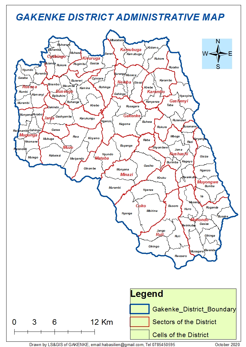
Gakenke District is one of the five Districts of Northern Province, Rwanda. The District covers an area of 704.06 km² and is administratively divided into 19 Sectors, 97 Cells, and 617 Villages. Gakenke is home to a population of 365,292, with a population density of 520 people per km². Women Count for 192,692 (52.8%) of the population, while Men are 172,600 (47.2%).
Boundaries of Gakenke District
Gakenke District shares borders with Musanze District in North, Nyabihu and Ngororero Districts in North-West, Muhanga District in Southwest, Kamonyi District in South, Rulindo District in East and Burera District in North-East. The District offices are located in Gakenke Sector, Rusagara Cell, Kabaya Village, at latitude 1.38924 and longitude 29.46466.